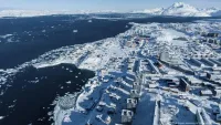
Severe floods and landslides triggered by extreme rainfall swept across multiple provinces in Sumatra in late November 2025, causing one of Indonesia’s worst natural disasters in recent years. More than 600 people were killed, hundreds remain missing, and widespread destruction has displaced communities across North Sumatra, West Sumatra, and Aceh.
Satellite Evidence Exposes Environmental Vulnerability
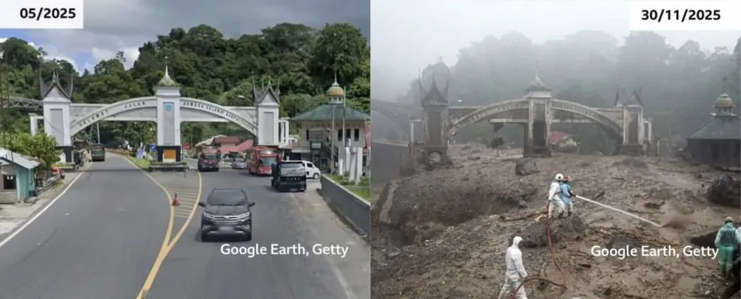
Before and after satellite imagery from Google Earth and other geospatial sources reveals dramatic landscape changes in the hardest hit regions. The images show washed out villages, submerged farmlands, collapsed roads, and entire river systems overflowing far beyond their normal boundaries.
Environmental analysts point to a deeper structural issue: years of deforestation and uncontrolled land clearing across upstream areas. Satellite archives from 2016–2025 reveal significant forest loss, thinning watershed protection, and expanding extractive activities that dramatically increased the region’s vulnerability.
Reuters and CNN Indonesia both highlighted how degraded hillsides and exposed soils intensified the scale of the disaster.
While Cyclone Senyar and seasonal monsoon rains triggered the floods, experts stress that the underlying ecological damage “loaded the dice” long before the storm arrived.
Human Toll and On the Ground Realities
Entire villages have been wiped out. In West Sumatra’s Palembayan district, Reuters documented the story of a man searching desperately for his missing wife among the debris of their destroyed home. Rural communities in Aceh and North Sumatra face prolonged shortages of clean water, food, electricity, and medical care.
More than a million people have been affected, with mass evacuations hampered by collapsed bridges and impassable roads. Emergency shelters continue to fill as aftershocks of landslides threaten additional areas.
Government Response and Policy Debate
The Indonesian government deployed emergency teams, military units, and air support to deliver aid. However, the disaster has reignited national debate about environmental governance. Civil society groups argue that long-term deforestation enabled by weak regulation and fragmented oversight has magnified disaster risks in Sumatra for decades.
Experts recommend that post-disaster recovery plans integrate ecological rehabilitation, stricter land-use controls, watershed restoration, and transparent monitoring using satellite data.
A Warning and a Turning Point
The 2025 Sumatra disaster is more than a weather event it is a stark illustration of how environmental degradation and climate driven extremes intersect. Satellite imagery has made the scale of the damage undeniable, offering a powerful visual record of what happens when ecosystems are pushed beyond their limits.
As rebuilding begins, the images serve as both evidence and warning: without systemic reforms, similar catastrophes will continue to threaten millions across Indonesia’s most vulnerable regions.